Blandford-Blenheim · Oxford County

Plattsville

A mill village on the Nith River in the northeast corner of Oxford County, close to the Waterloo Region line.

6 minute read

Map of Plattsville: every one of the Official Plan land use areas is shaded by the part of Plattsville it belongs to in our guide, with the rivers, main roads, and parks. Choose one to open it in our guide.Village coreMemorial ParkSamuel StreetNortheast
Oxford County Official Plan and OpenStreetMap
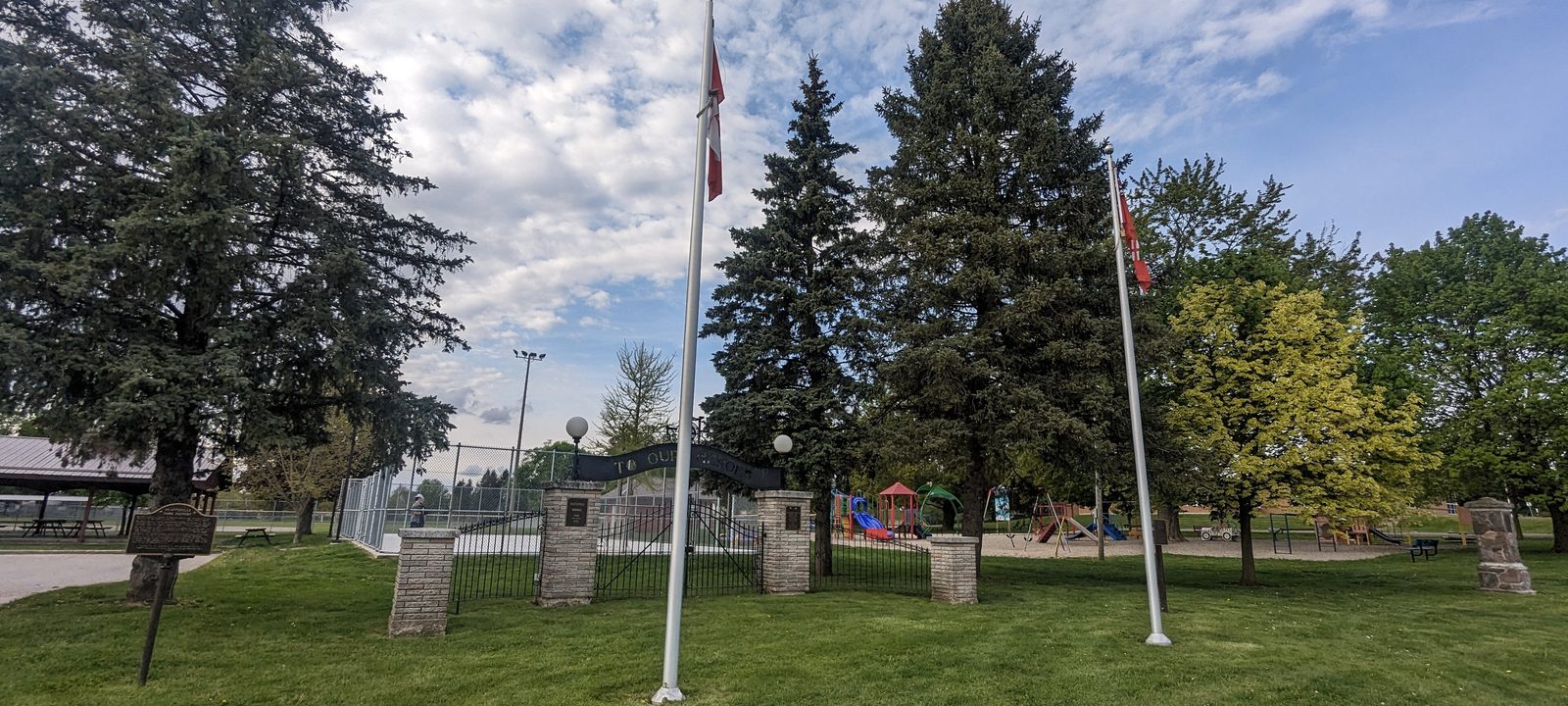
Memorial Park in Plattsville, Ontario
Memorial Park, Plattsville.
Photo: JFVoll, CC BY-SA 4.0

About Plattsville

Plattsville is a village on the Nith River in Blandford-Blenheim Township, in the northeast corner of Oxford County. Ayr and New Hamburg are both close by, across the line in Waterloo Region.

It takes its name from Samuel Platt, who came to Canada in 1844 and built a mill here around 1851. The village grew around his mills on the Nith, and it still has what a village needs day to day: a school with the library inside it, an arena, and Memorial Park.

Below you’ll find the village’s story, its park and arena, the school, and how people get around, then a walk through Plattsville itself. The Oxford County Official Plan maps the village by land use, so the areas on our map are the village core, the residential streets, the parks and school, and the industrial land.

Plattsville in depth

Samuel Platt’s mills

Samuel Platt came to Canada in 1844 and built Blenheim Mills on the Nith around 1851. He laid out the village beside the mill, and it took his name.

Industry stayed. The village’s sandpaper factory, on Albert Street West, is run today by Saint-Gobain. The township around the village, Blandford-Blenheim, was formed in 1975 when the two old townships joined.

Plattsville in depth

Memorial Park, the arena, and the curling club

Memorial Park and the arena share the grounds at 68 Mill Street East. The “To Our Heroes” Memorial Gate was dedicated in August 1921 to the men and women who served in the First World War, and it was moved to the present park in 1958. The village cenotaph is here too.

Skating and curling have a long history here. The Plattsville Curling Club dates from 1867, and an arena has stood at the corner of Mill and Platt streets since 1948.

Plattsville in depth

School and library

Plattsville and District Public School, at 112 Mill Street East, is the village’s elementary school, run by the Thames Valley District School Board. The Oxford County Library’s Plattsville branch is in the same building. There is no high school in the village, so older students travel for school. Boundaries change, so it is worth checking an address with the board before you buy.

Plattsville in depth

Getting around

You’ll want a car in Plattsville. Oxford Road 8 runs through it, and Ayr and New Hamburg, in Waterloo Region, are both a short drive away, with Highway 401 beyond Ayr.

Along Mill Street and the Nith

The village centre

The village centre runs along Mill Street, with the shops and the industrial land on the west side and the park, arena, and school on the east.

Map of The village centre in Plattsville: the Official Plan land use areas in this part are shaded, with the rivers, main roads, and parks. Each place in our guide is marked; choose one to read about it.Village coreMemorial Park
Oxford County Official Plan and OpenStreetMap

The village core

Mill Street and the village core

The village core is the stretch of Mill Street and Albert Street where Samuel Platt’s mills once stood, with the Saint-Gobain plant on Albert Street West. The County’s plan maps it as the village core and service commercial area, with the industrial land beside it.

Homes

A few homes among the shops and businesses.

Streets and landmarks

Mill Street East and West, Albert Street West, and Isabella Street.

On the County’s land use map: Village Core and Service Commercial and Industrial.

Green space on the Nith

Memorial Park, the school, and the river

East along Mill Street, the park, the arena, and the school sit side by side: Memorial Park and the arena at number 68, and Plattsville and District Public School, with the library, at number 112. The County also maps parkland along the Nith on the south side of the village.

Parks and green space

Memorial Park, with its 1921 Memorial Gate, and green space along the Nith.

Schools

Plattsville and District Public School, at 112 Mill Street East.

On the County’s land use map: Open Space, Park, and School.

North and east of Mill Street

The residential streets

Most homes are on the streets north of Mill Street, from the blocks around Samuel and Platt streets to the streets on the northeast side.

Map of The residential streets in Plattsville: the Official Plan land use areas in this part are shaded, with the rivers, main roads, and parks. Each place in our guide is marked; choose one to read about it.Samuel StreetNortheast
Oxford County Official Plan and OpenStreetMap

North of Mill Street

Samuel Street and Platt Street North

North of the core, Samuel Street, Platt Street North, and the streets around them are lined with homes, a short walk from the park and the school.

Homes

Village homes of different ages.

Streets and landmarks

Samuel Street, Platt Street North, Daniel Street, and Fennel Street.

On the County’s land use map: Low and Medium Density Residential.

Toward Hofstetter Road

The northeast streets

On the northeast side, residential streets such as Applewood Street, Glennbriar Street, and English Crescent run toward Hofstetter Road. Oxford County has a draft plan for a new subdivision of about 115 homes, mostly single detached, on the south side of Albert Street East between Platt Street South and Hofstetter Road.

Homes

Family homes, with a new subdivision planned nearby.

Streets and landmarks

Applewood Street, Glennbriar Street, English Crescent, and Todd Way.

On the County’s land use map: Low and Medium Density Residential.

Sources

Written from our work with clients here and the time we have spent getting to know the village, and checked against the sources below.

Each fact was checked against at least two sources. Neighbourhood names follow local usage, and the official areas each entry covers are listed under it. The streets named are examples rather than boundaries. Details such as school boundaries, zoning, and bus routes change, so please check anything important with the municipality, the transit agency, or the school board.