King Township, York Region

Nobleton

A crossroads village in King Township, just south of the Oak Ridges Moraine, that has grown quickly since its wastewater system was built.

5-minute read

Map of Nobleton: every one of the village boundary is shaded by the part of Nobleton it belongs to in our guide, with the rivers, main roads, and parks. Choose one to open it in our guide.VillageNorthand eastSouth
Ontario Municipal Boundaries, Nominatim, and OpenStreetMap contributors
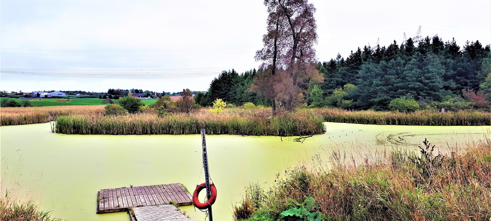
A green, algae-covered pond with a small wooden dock and a red life ring, ringed by tall grasses, with evergreens and farm fields beyond
The wetland at Cold Creek Conservation Area, just west of Nobleton.
Photo: Mhsheikholeslami, CC BY-SA 4.0

About Nobleton

Nobleton is a village in the Township of King, where King Road meets Highway 27, just north of Kleinburg. It takes its name from Joseph Noble, an early settler and tavern keeper, and sits just south of the Oak Ridges Moraine, among farms, forests, and hills, with the Humber River running through its southwest corner.

It was first settled in 1812, at a natural stopping point halfway between King City and Bolton and between Kleinburg and Schomberg, and taverns, hotels, and a general store grew up to serve travellers. New homes came slowly for many years, then faster after a municipal wastewater system was built. The village grew from about 4,900 people in 2016 to about 6,500 in 2021, and York Region is expanding the system to serve about 10,800 residents.

Below you’ll find the countryside around the village, schools, and how to get around, then a walk through Nobleton: the village centre and the newer streets.

Nobleton in depth

The moraine and the countryside

Nobleton sits among the farms and forests of King Township, with the Oak Ridges Moraine rising to the north and the lakes at Nobleton Lakes a couple of kilometres up the road. Just west of the village, Cold Creek Conservation Area, on the 11th Concession, has more than 7 km of marked trails through woods and wetlands.

For golf, Nobleton Lakes has 27 holes just north of the village, and Copper Creek is a short drive south near Kleinburg.

Nobleton in depth

A village that is growing

Homes first spread beyond the old crossroads in the 1950s and 1960s, and new subdivisions came to the north of the village in the 1990s and 2000s. Since the wastewater system was built, building has picked up, and York Region is upgrading the pumping station and treatment plant so the village can keep growing, to about 10,800 residents.

Nobleton in depth

Schools

Nobleton Public School, on Highway 27, is run by the York Region District School Board, and St. Mary Catholic Elementary School, on Greenside Drive, is run by the York Catholic District School Board. There is no high school in the village; public high school students go to King City Secondary School. Boundaries change as the village grows, so it is worth checking an address with the board before you buy.

Nobleton in depth

Getting around

King Road runs east and west through the village and Highway 27 runs north and south. Highway 400 is to the east, past King City, and Kleinburg and Highway 427 are to the south along Highway 27. Most people here get around by car.

King Road and Highway 27

The village centre

The crossroads at King Road and Highway 27, with the school, the library, and the older streets.

Map of The village centre in Nobleton: the village boundary in this part are shaded, with the rivers, main roads, and parks. Each place in our guide is marked; choose one to read about it.Village
Ontario Municipal Boundaries, Nominatim, and OpenStreetMap contributors

The crossroads

The village centre

The village grew up around the crossroads of King Road and Highway 27. Nobleton Public School is on Highway 27, the library branch of the King Township Public Library is just off it on McCutcheon Avenue, and shops and services sit along both roads near the corner.

Homes

Older homes and homes on larger lots near the crossroads.

Day to day

Shops and services on King Road and Highway 27, and the library.

On the village map: Nobleton, Township of King.

Where the village is growing

Newer streets

The newer subdivisions around the edges of the village.

Map of Newer streets in Nobleton: the village boundary in this part are shaded, with the rivers, main roads, and parks. Each place in our guide is marked; choose one to read about it.North and eastSouth
Ontario Municipal Boundaries, Nominatim, and OpenStreetMap contributors

Newer streets

North and east

North and east of the crossroads, newer streets of homes have been built since the 1990s, more of them since the wastewater system came in, with St. Mary Catholic Elementary School on Greenside Drive.

Homes

Newer detached homes.

School

St. Mary Catholic Elementary School.

On the village map: Nobleton, Township of King.

Toward Kleinburg

South Nobleton

South of King Road, the streets toward the southwest edge of the village include some of its older subdivisions, with homes on larger lots, and the Humber River valley beyond.

Homes

Older homes on larger lots and newer houses.

Getting around

Highway 27 south toward Kleinburg.

On the village map: Nobleton, Township of King.

Everyday drives

Real drives, day to day

Drives from this area to universities and colleges, major employers, hospitals, GO stations, and more, sorted nearest first. Times are by car without traffic.

See all 20 drives for this area on a map
Universities and collegesNearest about 22 minutes
  • From Nobleton to Seneca, King campus: about 22 minutesCollege16 km by road, without traffic
  • From Nobleton to Humber College, North campus: about 25 minutesCollege23 km by road, without traffic
  • From Nobleton to York University, Keele campus: about 27 minutesUniversity29 km by road, without traffic
  • From Nobleton to Sheridan College, Mississauga campus: about 38 minutesCollege41 km by road, without traffic
Major employersNearest about 44 minutes
  • From Nobleton to Honda, Alliston plant: about 44 minutes43 km by road, without traffic
  • From Nobleton to First Canadian Place, Financial District: about 46 minutes52 km by road, without traffic
  • From Nobleton to Ford, Oakville Assembly Complex: about 48 minutes55 km by road, without traffic
HospitalsNearest about 17 minutes
  • From Nobleton to Cortellucci Vaughan Hospital: about 17 minutes17 km by road, without traffic
DowntownNearest about 22 minutes
  • From Nobleton to the Vaughan Metropolitan Centre: about 22 minutes23 km by road, without traffic
GO stations and Union StationNearest about 15 minutes
  • From Nobleton to King City GO Station: about 15 minutes11 km by road, without traffic
AirportsNearest about 38 minutes
  • From Nobleton to Pearson Airport: about 38 minutes38 km by road, without traffic
Sports and entertainmentNearest about 13 minutes
  • From Nobleton to the McMichael Canadian Art Collection: about 13 minutes8.4 km by road, without traffic
GolfNearest about 8 minutes
  • From Nobleton to Copper Creek Golf Club: about 8 minutes5.6 km by road, without traffic
Schools, markets, and main streetsNearest about 15 minutes
  • From Nobleton to King City Secondary School: about 15 minutes11 km by road, without traffic

Selling

Selling a larger home in Nobleton

Selling a larger home or a property with some land in Nobleton? We’ll advise you to have the right checks done early, like the well, the septic system, and any outbuildings, then price it from recent sales nearby and plan the photos and timing with you.

Book a conversation

Nobleton

Questions people ask

Who can help me buy or sell a home in Nobleton?

We can. We’re Tanner Hickey and Robin Hickey of RE/MAX Real Estate Centre Inc., Brokerage, based in Cambridge and working with clients across Ontario. Call Tanner at 519-716-4806 or Robin at 519-240-8984, or book a conversation.

What’s it like to live in Nobleton?

Nobleton is a village where King Road meets Highway 27, among farms, forest, and hills just south of the Oak Ridges Moraine. It grew slowly for years, then faster once the wastewater system came in, going from about 4,900 people in 2016 to about 6,500 in 2021.

How far is Nobleton from the city?

Pearson is about 40 minutes without traffic, and Union Station is about 45.

Who can help me sell a larger home in Nobleton?

We can. A house on some land brings its own questions, so we’ll advise you to have the well, the septic system, and any barns or outbuildings checked early, and we price it from recent sales nearby with our reasoning shown. Here’s how we handle rural properties, or ask for an opinion of value.

Book a conversation

Sources

Written from our work with clients here and the time we have spent getting to know the city, and checked against the sources below.

Each fact was checked against at least two sources. Neighbourhood names follow local usage, and the official areas each entry covers are listed under it. The streets named are examples rather than boundaries. Details such as school boundaries, zoning, and bus routes change, so please check anything important with the municipality, the transit agency, or the school board.