York Region

Vaughan

A city of five communities just north of Toronto, from the old village streets of Woodbridge and Thornhill to a new downtown at the end of the subway line.

7-minute read

Map of Vaughan: every one of the city boundary is shaded by the part of Vaughan it belongs to in our guide, with the rivers, main roads, and parks. Choose one to open it in our guide.WoodbridgeMapleThornhillConcordVMC
Ontario Municipal Boundaries, Nominatim, and OpenStreetMap contributors
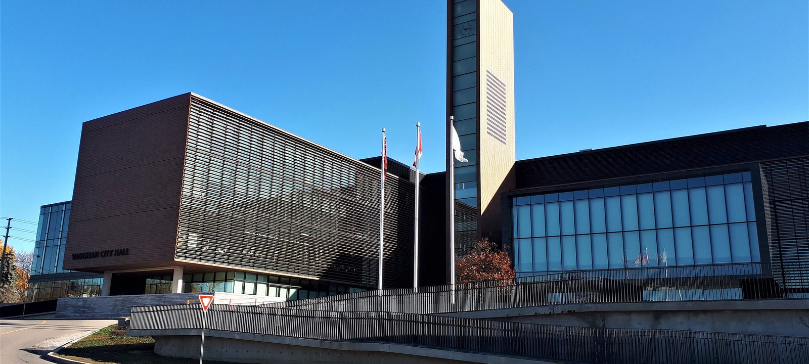
Vaughan City Hall, a long building of dark panels and glass with a tall slender tower, three flagpoles out front, and a clear blue sky
Vaughan City Hall, in Maple.
Photo: Mhsheikholeslami, CC BY-SA 4.0

About Vaughan

Vaughan sits directly north of Toronto, between Steeles Avenue and the King Township line, and is home to about 323,000 people. It’s made up of five communities, Woodbridge, Maple, Thornhill, Concord, and Kleinburg, each of which began as its own village before the township grew around them. The Township of Vaughan and the Village of Woodbridge joined in 1971, and Vaughan became a city in 1991.

It’s a city of strong neighbourhoods and family homes, with the Humber River valleys running down its west side and a new downtown rising at Vaughan Metropolitan Centre, where the subway now ends. Canada’s Wonderland, Vaughan Mills, and the Cortellucci Vaughan Hospital are all here.

Below you’ll find the subway and the new downtown, the hospital, the parks and the Humber, schools, and how to get around, then a walk through Vaughan’s communities. Kleinburg has a guide of its own.

Vaughan in depth

The subway and a new downtown

On December 17, 2017, Line 1 of the TTC subway was extended north into Vaughan, with stations at Pioneer Village, Highway 407, and Vaughan Metropolitan Centre, the end of the line. Around the Vaughan Metropolitan Centre station, at Highway 7 and Jane Street, the city is building a new downtown, with condo towers, offices, and parks going up on land that was once mostly industrial.

Highway 7 is also a rapid transit corridor, with Viva buses running in their own lanes and connecting the subway with Richmond Hill and Markham to the east.

Vaughan in depth

The hospital

Cortellucci Vaughan Hospital, run by Mackenzie Health, opened as a full-service hospital on June 6, 2021, at Major Mackenzie Drive and Jane Street. It was Vaughan’s first hospital, and it was described as the first new hospital built in Ontario in more than 30 years and as Canada’s first smart hospital, with its systems and medical devices connected so they can share information.

Vaughan in depth

Parks, the Humber, and days out

Branches of the Humber River run through the west side of the city, through Woodbridge and Kleinburg, with trails along the valleys. In Maple, Canada’s Wonderland has been open since 1981, and Vaughan Mills, a large shopping mall by Highway 400, opened in 2004. The Woodbridge Fall Fair has been held since 1847.

For golf, Vaughan has public courses like Eagles Nest in Maple and Copper Creek near Kleinburg, and private clubs including the National and Maple Downs.

Vaughan in depth

Schools

Public schools are run by the York Region District School Board, and Catholic schools by the York Catholic District School Board, with French-language schools as well. Public high schools include Emily Carr and Tommy Douglas in Woodbridge, Maple High School, and Westmount Collegiate and Stephen Lewis in Thornhill. Catholic high schools include Father Bressani and St. Jean de Brebeuf in Woodbridge, St. Joan of Arc in Maple, and St. Elizabeth in Thornhill. Boundaries change as the city grows, so it is worth checking an address with the board before you buy.

Vaughan in depth

Getting around

Highway 400 runs north through the middle of the city, Highway 407 crosses it east to west, and Highway 427 runs up the west side past Woodbridge. GO trains on the Barrie line stop at Rutherford and Maple, and York Region Transit and Viva buses connect the communities to the subway.

The old village and the Humber

Woodbridge

The west side of the city, around the old village on the Humber River, with Market Lane and the fairgrounds.

Map of Woodbridge in Vaughan: the city boundary in this part are shaded, with the rivers, main roads, and parks. Each place in our guide is marked; choose one to read about it.Woodbridge
Ontario Municipal Boundaries, Nominatim, and OpenStreetMap contributors

Market Lane and the Humber

Woodbridge

Woodbridge began in the 1830s as Burwick, a mill village on the Humber River, and took its present name in 1855. The old village centre, around Woodbridge Avenue and Market Lane, still has shops and restaurants, and the fairgrounds where the Woodbridge Fall Fair has been held for generations are close by. Around it, streets of homes from many decades spread north and west, with newer subdivisions toward Highway 427.

Homes

Older homes near the village, postwar and newer houses, and some condos.

Day to day

Market Lane, Woodbridge Avenue, and shopping along Highway 7.

On the city map: City of Vaughan.

City Hall, the hospital, and Wonderland

Maple

The centre of the city, around the old crossroads at Keele Street and Major Mackenzie Drive.

Map of Maple in Vaughan: the city boundary in this part are shaded, with the rivers, main roads, and parks. Each place in our guide is marked; choose one to read about it.Maple
Ontario Municipal Boundaries, Nominatim, and OpenStreetMap contributors

City Hall and the civic centre

Maple

Maple began as a crossroads village at Keele Street and Major Mackenzie Drive and grew after the railway arrived in 1853. Vaughan City Hall, designed by KPMB and opened in 2011, is here, along with Maple GO station, the Cortellucci Vaughan Hospital to the west at Jane Street, and Canada’s Wonderland by Highway 400. Most of its homes are on streets built from the late 1970s on, including the land of the old Maple Airport, which closed in 1987.

Homes

Mostly newer detached and semi-detached homes and townhouses.

Landmarks

City Hall, Maple GO, the hospital, and Canada’s Wonderland.

On the city map: City of Vaughan.

The old village on Yonge Street

Thornhill

The east side of the city, west of Yonge Street, where Thornhill is shared with Markham.

Map of Thornhill in Vaughan: the city boundary in this part are shaded, with the rivers, main roads, and parks. Each place in our guide is marked; choose one to read about it.Thornhill
Ontario Municipal Boundaries, Nominatim, and OpenStreetMap contributors

The Vaughan side of Yonge Street

Thornhill

Thornhill grew around Benjamin Thorne’s mills and took its name in 1829. Yonge Street runs down the middle, with the west side in Vaughan and the east side in Markham, and each city has its own heritage district protecting the old village. West of Yonge, residential streets lead toward Bathurst Street and beyond.

Homes

Heritage homes near Yonge Street, postwar and newer houses, and condos along the main roads.

History

The Thornhill Heritage Conservation District.

On the city map: City of Vaughan.

Around Highway 7

Concord and the new downtown

The south of the city along Highway 7, from the old Concord crossroads to the towers at Vaughan Metropolitan Centre.

Map of Concord and the new downtown in Vaughan: the city boundary in this part are shaded, with the rivers, main roads, and parks. Each place in our guide is marked; choose one to read about it.ConcordVMC
Ontario Municipal Boundaries, Nominatim, and OpenStreetMap contributors

The old crossroads at Highway 7

Concord

Concord started as a small rural community in the 1850s. After Highway 400 opened in 1951 and the CN rail yard came, it became Vaughan’s main industrial area, and today business parks fill much of the area, with homes on the streets around them.

Homes

Residential streets mixed with business parks.

Work

One of the city’s main employment areas.

On the city map: City of Vaughan.

The new downtown

Vaughan Metropolitan Centre

At Highway 7 and Jane Street, the end of the subway line, Vaughan is building its new downtown. Towers of condos and offices stand around the station, with a YRT bus terminal a short walk away, and more is under construction.

Homes

Mostly condos in new towers.

Getting around

The subway and Viva buses on Highway 7.

On the city map: City of Vaughan.

Everyday drives

Real drives, day to day

Drives from this area to universities and colleges, major employers, hospitals, GO stations, and more, sorted nearest first. Times are by car without traffic.

See all 20 drives for this area on a map
Universities and collegesNearest about 6 minutes
  • From Concord to York University, Keele campus: about 6 minutesUniversity3.7 km by road, without traffic
  • From Concord to York University, Markham campus: about 18 minutesUniversity20 km by road, without traffic
  • From Concord to Seneca, Newnham campus: about 18 minutesCollege21 km by road, without traffic
  • From Concord to Humber College, North campus: about 19 minutesCollege15 km by road, without traffic
Major employersNearest about 33 minutes
  • From Concord to First Canadian Place, Financial District: about 33 minutes29 km by road, without traffic
  • From Concord to Ford, Oakville Assembly Complex: about 37 minutes45 km by road, without traffic
HospitalsNearest about 7 minutes
  • From Maple to Cortellucci Vaughan Hospital: about 7 minutes3.9 km by road, without traffic
DowntownNearest under 10 minutes
  • From Concord to the Vaughan Metropolitan Centre: under 10 minutes2.7 km by road, without traffic
GO stations and Union StationNearest about 31 minutes
  • From Thornhill to Union Station, Toronto: about 31 minutes33 km by road, without traffic
AirportsNearest about 28 minutes
  • From Woodbridge to Pearson Airport: about 28 minutes27 km by road, without traffic
Sports and entertainmentNearest about 14 minutes
  • From Woodbridge to the McMichael Canadian Art Collection: about 14 minutes8.5 km by road, without traffic
Parks and outdoorsNearest about 13 minutes
  • From Woodbridge to the Kortright Centre: about 13 minutes6.0 km by road, without traffic
  • From Thornhill to Earl Bales Park: about 15 minutes9.5 km by road, without traffic
GolfNearest about 10 minutes
  • From Maple to Maple Downs Golf and Country Club: about 10 minutes5.7 km by road, without traffic

Selling

Selling a larger home in Vaughan

Thinking of selling a family home or a larger home in Vaughan? We’ll start with an honest opinion of value, with the reasons behind it, then plan the preparation, the photography, and the timing with you. If you’d rather keep it private, we’ll talk through a more discreet approach.

Book a conversation

Vaughan

Questions people ask

Who can help me buy or sell a home in Vaughan?

We can help. We’re Tanner Hickey and Robin Hickey of RE/MAX Real Estate Centre Inc., Brokerage, based in Cambridge and working with clients across Ontario. You work with both of us directly. Call Tanner at 519-716-4806 or Robin at 519-240-8984, or book a conversation.

What’s it like to live in Vaughan?

Vaughan is five communities that each started as a village: Woodbridge, Maple, Thornhill, Concord, and Kleinburg. It’s a city of family homes and strong neighbourhoods, with the Humber valleys on the west side and a new downtown rising where the subway now ends.

How long is the drive from Vaughan to Toronto?

On a clear road, about half an hour to Union Station, and Pearson is a little closer. The subway from Vaughan Metropolitan Centre is the other way in.

Who can help me sell a larger home in Vaughan?

That’s us. We’ll walk through the house with you, tell you what’s worth doing before you list and what you can leave alone, and plan the photos and the timing around your next move. To see where your home stands, ask for an opinion of value.

Book a conversation

Sources

Written from our work with clients here and the time we have spent getting to know the city, and checked against the sources below.

Each fact was checked against at least two sources. Neighbourhood names follow local usage, and the official areas each entry covers are listed under it. The streets named are examples rather than boundaries. Details such as school boundaries, zoning, and bus routes change, so please check anything important with the municipality, the transit agency, or the school board.