Caledon, Peel Region

Bolton

Caledon’s largest community, a mill village on the Humber River that has grown up the hills on either side, with conservation land and trails all around.

5-minute read

Map of Bolton: every one of the community boundary is shaded by the part of Bolton it belongs to in our guide, with the rivers, main roads, and parks. Choose one to open it in our guide.DowntownNorth HillSouth Hill
Ontario Municipal Boundaries, Town of Caledon, Nominatim, and OpenStreetMap contributors
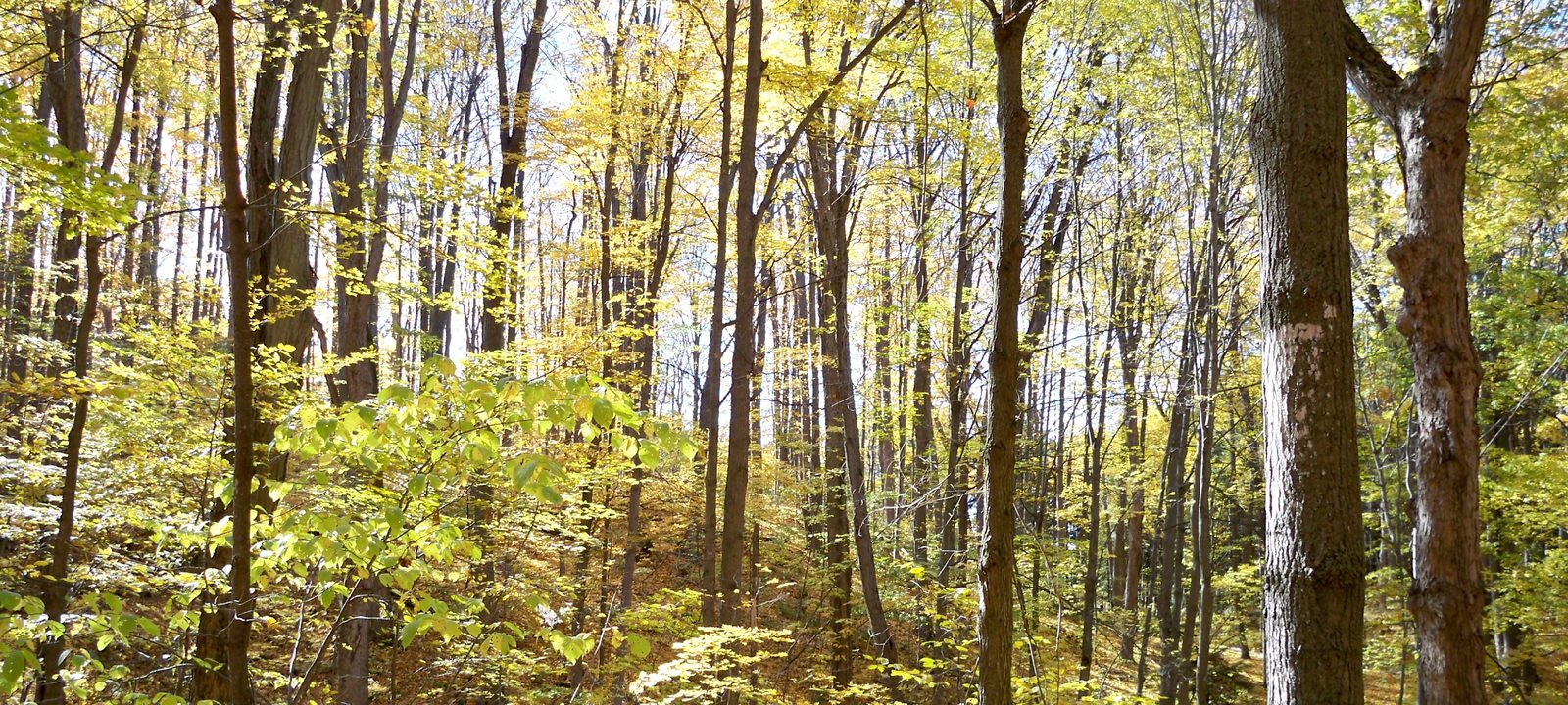
A forest of tall, slender trees in early autumn, with sunlight coming through yellow and green leaves
The woods at Albion Hills Conservation Park, north of Bolton.
Photo: Nelro2 (talk), public domain

About Bolton

Bolton sits in the Humber River valley in the southeast corner of Caledon and is its largest community, with about 26,800 people. In 1821, George Bolton bought land along the river, and the next year his brother James, a millwright, built a dam and a grist mill. The village that grew up around the mill was known as Bolton Mills, and by 1857 it had about 700 people.

Today the old village is downtown, where Queen Street and King Street meet near the river, and neighbourhoods have climbed the hills to the north and east. Conservation land covers much of the valley to the north and east, and the Oak Ridges Moraine and farmland surround the town.

Below you’ll find the river and the trails, the fall fair and Bolton Camp, schools, and how to get around, then a walk through Bolton: downtown, North Hill, and South Hill. Our guide to Caledon covers the rest of the town.

Bolton in depth

The Humber and the trails

The Humber Valley Heritage Trail follows the river through Bolton, past Bolton Mill Park, where the first dam stood, and on through the conservation lands to the north. Just up Highway 50, Albion Hills Conservation Park has 538 hectares of forest, with mountain bike trails and camping.

For golf, Glen Eagle, with 27 public holes, and Caledon Woods, a private ClubLink course on the Humber, are both just north of town on Highway 50.

Bolton in depth

The fair and Bolton Camp

The Albion Bolton Agricultural Society was founded in 1857 and bought its fairgrounds on Queen Street in 1868. It still runs the fall fair there, along with a truck and tractor pull.

Bolton Camp opened in 1922 as a fresh-air camp in the Humber valley for families from Toronto and ran until 1999. The Toronto and Region Conservation Authority bought the land in 2011 and is restoring it as a community hub, with trails, historic buildings, and space for arts and recreation.

Bolton in depth

Schools

Public schools are run by the Peel District School Board, and Catholic schools by the Dufferin-Peel Catholic District School Board. Humberview Secondary School is on Kingsview Drive and St. Michael Catholic Secondary School is on Columbia Way, both in North Hill, and Allan Drive Middle School is in South Hill, with elementary schools across town. Boundaries change as the town grows, so it is worth checking an address with the board before you buy.

Bolton in depth

Getting around

Queen Street, once Highway 50 and now Peel Road 50, runs north and south through town as the main street, and King Street runs east and west across Caledon. Highway 427 ends at Major Mackenzie Drive, about 9 km southeast, and Highway 400 is about 14 km east, at King Road. Most people here get around by car.

Queen Street and the river

Downtown

The old village, where Queen Street and King Street meet near the Humber.

Map of Downtown in Bolton: the community boundary in this part are shaded, with the rivers, main roads, and parks. Each place in our guide is marked; choose one to read about it.Downtown
Ontario Municipal Boundaries, Town of Caledon, Nominatim, and OpenStreetMap contributors

Queen Street and King Street

Downtown Bolton

Downtown is the old village, along Queen Street around King Street, with shops and restaurants in older buildings and Bolton Mill Park on the river. The fairgrounds are just south on Queen Street.

Homes

Older homes on the streets around Queen Street, with some newer infill.

Day to day

Shops and restaurants on Queen Street, Mill Park, and the river trail.

On the community map: Bolton, Town of Caledon.

The high schools and Bolton Camp

North Hill

The neighbourhoods north of downtown, with both high schools and Bolton Camp.

Map of North Hill in Bolton: the community boundary in this part are shaded, with the rivers, main roads, and parks. Each place in our guide is marked; choose one to read about it.North Hill
Ontario Municipal Boundaries, Town of Caledon, Nominatim, and OpenStreetMap contributors

Schools and the valley

North Hill

North Hill rises above downtown, with Humberview Secondary School on Kingsview Drive, St. Michael Catholic Secondary School on Columbia Way, and Bolton Camp in the valley on its edge.

Homes

Family homes of many decades.

Schools

Humberview and St. Michael.

On the community map: Bolton, Town of Caledon.

East of Queen Street

South Hill

The neighbourhoods on the hill east of downtown.

Map of South Hill in Bolton: the community boundary in this part are shaded, with the rivers, main roads, and parks. Each place in our guide is marked; choose one to read about it.South Hill
Ontario Municipal Boundaries, Town of Caledon, Nominatim, and OpenStreetMap contributors

Allan Drive

South Hill

South Hill is on the rise east of downtown, a neighbourhood of family streets around Allan Drive, with Allan Drive Middle School at its centre.

Homes

Family homes of many decades.

School

Allan Drive Middle School.

On the community map: Bolton, Town of Caledon.

Everyday drives

Real drives, day to day

Drives from this area to universities and colleges, major employers, hospitals, GO stations, and more, sorted nearest first. Times are by car without traffic.

See all 21 drives for this area on a map
Universities and collegesNearest about 25 minutes
  • From downtown Bolton to Humber College, North campus: about 25 minutesCollege23 km by road, without traffic
  • From downtown Bolton to Seneca, King campus: about 33 minutesCollege23 km by road, without traffic
  • From North Hill to York University, Keele campus: about 37 minutesUniversity34 km by road, without traffic
  • From downtown Bolton to Sheridan College, Mississauga campus: about 39 minutesCollege41 km by road, without traffic
Major employersNearest about 41 minutes
  • From downtown Bolton to Honda, Alliston plant: about 41 minutes39 km by road, without traffic
  • From downtown Bolton to First Canadian Place, Financial District: about 47 minutes52 km by road, without traffic
  • From downtown Bolton to Ford, Oakville Assembly Complex: about 49 minutes55 km by road, without traffic
HospitalsNearest about 27 minutes
  • From downtown Bolton to Cortellucci Vaughan Hospital: about 27 minutes24 km by road, without traffic
DowntownNearest about 32 minutes
  • From downtown Bolton to the Vaughan Metropolitan Centre: about 32 minutes26 km by road, without traffic
GO stations and Union StationNearest about 26 minutes
  • From downtown Bolton to King City GO Station: about 26 minutes19 km by road, without traffic
AirportsNearest about 39 minutes
  • From downtown Bolton to Pearson Airport: about 39 minutes38 km by road, without traffic
Sports and entertainmentNearest about 20 minutes
  • From downtown Bolton to the McMichael Canadian Art Collection: about 20 minutes13 km by road, without traffic
Parks and outdoorsNearest about 21 minutes
  • From North Hill to Albion Hills Conservation Park: about 21 minutes17 km by road, without traffic
GolfNearest about 10 minutes
  • From downtown Bolton to Caledon Woods Golf Club: about 10 minutes6.9 km by road, without traffic
Schools, markets, and main streetsNearest under 10 minutes
  • From downtown Bolton to Humberview Secondary School: under 10 minutes1.6 km by road, without traffic

Selling

Selling a larger home in Bolton

Every larger home in Bolton is a little different, so we price it from recent sales nearby and what’s for sale now, not a formula, and we show you our reasoning. Then we prepare the house to show well and agree with you in advance how public the marketing should be.

Book a conversation

Bolton

Questions people ask

Who can help me buy or sell a home in Bolton?

Happy to help with that. We’re Tanner Hickey and Robin Hickey, Sales Representatives with RE/MAX Real Estate Centre Inc., Brokerage, and we work with clients across Ontario. You’ll deal with both of us directly. Call Tanner at 519-716-4806 or Robin at 519-240-8984, or book a conversation.

What’s it like to live in Bolton?

Bolton sits down in the Humber valley. The old village is downtown, where Queen Street and King Street meet near the river, and the newer neighbourhoods have climbed the hills to the north and east. There’s conservation land and farmland all around.

How long is the drive from Bolton to Pearson?

About 40 minutes without traffic, and Union Station is a little under 50.

Who can help me sell a larger home in Bolton?

We’d be glad to. Robin has been selling real estate since 1985 and Tanner since 2018, and with a larger home that experience shows in the details: a careful price, a house that shows well, and privacy if you’d rather the neighbours not know yet. Here’s how we sell family and larger homes.

Book a conversation

Sources

Written from our work with clients here and the time we have spent getting to know the city, and checked against the sources below.

Each fact was checked against at least two sources. Neighbourhood names follow local usage, and the official areas each entry covers are listed under it. The streets named are examples rather than boundaries. Details such as school boundaries, zoning, and bus routes change, so please check anything important with the municipality, the transit agency, or the school board.