Wellington County

Erin

Two villages in the hills at the top of the Credit River, Erin and Hillsburgh, with farms and hamlets around them and one of the oldest fall fairs in the province.

6-minute read

Map of Erin: every one of the urban centres is shaded by the part of Erin it belongs to in our guide, with the rivers, main roads, and parks. Choose one to open it in our guide.Main StreetCentre 2000Hillsburgh
County of Wellington (urban centre boundaries) and OpenStreetMap contributors
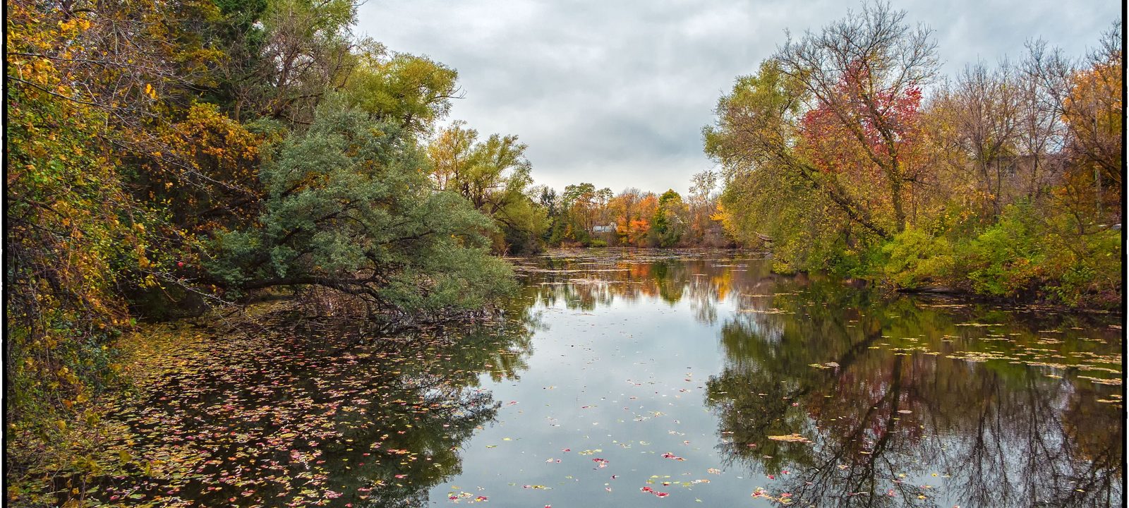
The Credit River in Erin, a still pond reflecting orange and green autumn trees under a pale sky
The Credit River in Erin in the fall.
Photo: Joe deSousa, CC0

About Erin

The Town of Erin is a rural town of about 12,000 people in the southeast corner of Wellington County, with Caledon to the east and Halton Hills to the south. It has two villages, Erin and Hillsburgh, and a scatter of hamlets in the countryside around them: Ballinafad, Brisbane, Cedar Valley, Crewson’s Corners, Ospringe, and Orton.

The village of Erin grew up around mills built on the Credit River in the late 1820s. The Credit Valley Railway arrived in 1879, the same year Erin became a village. Hillsburgh, a few minutes northwest, has its own main street and schools. Between them is farm country, rolling and wooded, and many people here commute to jobs in the cities to the south and east.

Below you’ll find the fall fair and the trail, the town’s new wastewater system, the schools, and how to get around, then a walk through the village of Erin and Hillsburgh.

Erin in depth

The fall fair and the countryside

The Erin Agricultural Society was formed in 1850, and its fair has become a Thanksgiving weekend tradition, held at the fairgrounds on Main Street in the village. It’s a real country fair, with cattle, horses, sheep, and goats on show, and quilts and baking in the exhibit hall, and a demolition derby.

Around the villages, the countryside is hilly and wooded, with the Credit River’s headwaters running through it. There is golf close to the village, too: Erin Heights, a family run public nine, and Calerin, a semi-private nine with separate tees for a full 18.

Erin in depth

The Elora Cataract Trailway

The old Canadian Pacific rail line through town is now the Elora Cataract Trailway, a 47 kilometre trail from Elora to the Forks of the Credit, through Hillsburgh and Erin. It’s used for walking, cycling, and cross-country skiing. The section between Hillsburgh and Erin is closed while a sewer line is built under it, so check the conservation authorities’ trail notices before you go.

Erin in depth

Wastewater and growth

Erin is building a municipal wastewater system for the village of Erin and Hillsburgh, and it’s coming in stages. Hillsburgh’s local sewers are in, the trunk line along the trail to the treatment plant is scheduled to be finished in late 2026, and existing homes in the village of Erin are expected to connect in 2027 and 2028.

The new system is also opening the way for new subdivisions. If you are buying in either village, ask about the timing and cost of connecting for that street, and whether the home is on a septic system today.

Erin in depth

Schools and health care

Public schools are run by the Upper Grand District School Board: Erin Public School on Daniel Street, Ross R. MacKay Public School in Hillsburgh, Brisbane Public School in the countryside, and Erin District High School on Boland Drive in the Centre 2000 complex, alongside the arena. Catholic schools are run by the Wellington Catholic District School Board, with St. John Brebeuf Catholic School in Hillsburgh. Boundaries change, so check the address with the school boards before you buy.

There is no hospital in town. The East Wellington Family Health Team has a clinic in the village of Erin, and hospitals in Orangeville, Georgetown, Guelph, and Fergus serve the area.

Erin in depth

Getting around

Erin is about 80 kilometres northwest of Toronto, and most people drive. There is no train in town; the nearest GO stations are in Georgetown and Acton, to the south in Halton Hills.

Main Street and the Credit

The village of Erin

The larger of the two villages, on the Credit River, with Main Street, the fairgrounds, the high school, and newer streets around the edges.

Map of The village of Erin in Erin: the urban centres in this part are shaded, with the rivers, main roads, and parks. Each place in our guide is marked; choose one to read about it.Main StreetCentre 2000
County of Wellington (urban centre boundaries) and OpenStreetMap contributors

The old village

Main Street and the river

The village grew along Main Street, close to the Credit River, where the first mills stood. The shops and restaurants are here, along with the fairgrounds where the fall fair is held, and the trail crosses Main Street at the edge of downtown.

Homes

Older village homes on the streets off Main Street.

Day to day

Shops, restaurants, and services along Main Street.

The County’s urban centre boundaries: Erin village.

Schools, the arena, and newer streets

Daniel Street and Centre 2000

North of downtown, Erin Public School is on Daniel Street, and Erin District High School shares the Centre 2000 complex on Boland Drive with the arena. The streets around them are a mix of older homes and newer subdivisions.

Homes

Detached homes from several decades, with newer subdivisions at the edges of the village.

Schools

Erin Public School and Erin District High School.

The County’s urban centre boundaries: Erin village.

The smaller village

Hillsburgh

A few minutes northwest of Erin, Hillsburgh has its own main street on Trafalgar Road, two schools, and the trail running through.

Map of Hillsburgh in Erin: the urban centres in this part are shaded, with the rivers, main roads, and parks. Each place in our guide is marked; choose one to read about it.Hillsburgh
County of Wellington (urban centre boundaries) and OpenStreetMap contributors

Trafalgar Road and the trail

Hillsburgh

Hillsburgh’s main street runs along Trafalgar Road. Ross R. MacKay Public School is on Trafalgar Road, St. John Brebeuf Catholic School is at the north end of the village, and the Elora Cataract Trailway passes through on its way between Elora and Erin. Hillsburgh’s new local sewers are already in.

Homes

Older village homes and newer streets, with country properties close by.

Schools

Ross R. MacKay Public School and St. John Brebeuf Catholic School.

The County’s urban centre boundaries: Hillsburgh.

Everyday drives

Real drives, day to day

Drives from this area to universities and colleges, major employers, hospitals, GO stations, and more, sorted nearest first. Times are by car without traffic.

See all 26 drives for this area on a map
Universities and collegesNearest about 43 minutes
  • From Hillsburgh to the University of Guelph: about 43 minutesUniversity37 km by road, without traffic
  • From Erin village to Sheridan College, Mississauga campus: about 54 minutesCollege56 km by road, without traffic
  • From Erin village to Sheridan College, Trafalgar campus in Oakville: about 57 minutesCollege50 km by road, without traffic
  • From Erin village to Humber College, North campus: about 57 minutesCollege55 km by road, without traffic
Major employersNearest about 38 minutes
  • From Erin village to Linamar, Guelph head office: about 38 minutes33 km by road, without traffic
  • From Erin village to Ford, Oakville Assembly Complex: about 56 minutes54 km by road, without traffic
  • From Erin village to Honda, Alliston plant: about 58 minutes57 km by road, without traffic
  • From Erin village to Toyota, Cambridge plant: about 60 minutes52 km by road, without traffic
HospitalsNearest about 25 minutes
  • From Erin village to Georgetown Hospital: about 25 minutes21 km by road, without traffic
  • From Hillsburgh to Groves Memorial Community Hospital: about 35 minutes31 km by road, without traffic
GO stations and Union StationNearest about 26 minutes
  • From Erin village to Acton GO Station: about 26 minutes23 km by road, without traffic
  • From Erin village to Georgetown GO Station: about 28 minutes23 km by road, without traffic
AirportsNearest about 57 minutes
  • From Erin village to Pearson Airport: about 57 minutes55 km by road, without traffic
Parks and outdoorsNearest about 11 minutes
  • From Erin village to Belfountain Conservation Area: about 11 minutes7.2 km by road, without traffic
  • From Hillsburgh to the Elora Gorge Conservation Area: about 47 minutes37 km by road, without traffic
GolfNearest under 10 minutes
  • From Erin village to Erin Heights Golf Course: under 10 minutes1.8 km by road, without traffic

Selling

Selling a larger home in Erin

Larger homes and country properties in Erin each have their own story, so we price them carefully, prepare them to show well, and keep the sale private if you prefer. You deal with the two of us directly from the first visit to closing day.

Book a conversation

Erin

Questions people ask

Who can help me buy or sell a home in Erin?

That would be us. We’re Tanner Hickey and Robin Hickey of RE/MAX Real Estate Centre Inc., Brokerage, based in Cambridge, with clients across Ontario. Call Tanner at 519-716-4806 or Robin at 519-240-8984, or book a conversation.

What’s it like to live in Erin?

The Town of Erin is two villages, Erin and Hillsburgh, with rolling, wooded farm country between them and a handful of hamlets around. The village of Erin grew up around mills on the Credit River, and Hillsburgh has its own main street and schools.

Do people commute from Erin?

Many people here work in the cities to the south and east. Without traffic, downtown Guelph is under 40 minutes and Pearson is just under an hour.

Who can help me sell a larger home in Erin?

We’d be glad to. Whether it’s a larger home in the village or a property with acreage, we plan the preparation, the photos, and the timing with you, and keep things private if you prefer. See how we sell family and larger homes and rural and farm properties.

Book a conversation

Sources

Written from our work with clients here and the time we have spent getting to know the city, and checked against the sources below.

Each fact was checked against at least two sources. Neighbourhood names follow local usage, and the official areas each entry covers are listed under it. The streets named are examples rather than boundaries. Details such as school boundaries, zoning, and bus routes change, so please check anything important with the municipality, the transit agency, or the school board.